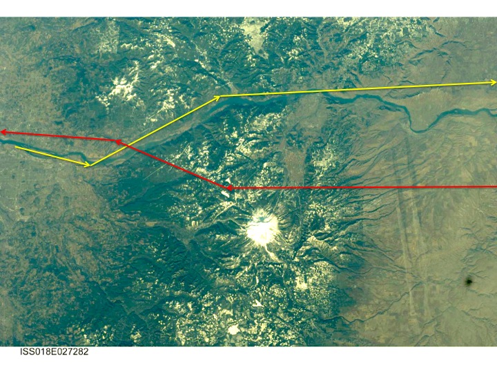
Flights departing PDX for cities in Nevada, Arizona, and sometimes southern California pass the south flank of Mt Hood while climbing through ~20,000. From late October thru May you often see this view on the north side of the plane on a “clear” day:

This picture was taken on November 11, 2012 on what passes for a clear autumn day in Portland. The upper 2500 feet on the south side are visible above the clouds.
During the late summer, the snow fields melt away, as do the small glaciers. The view from the ground in September looks like this:
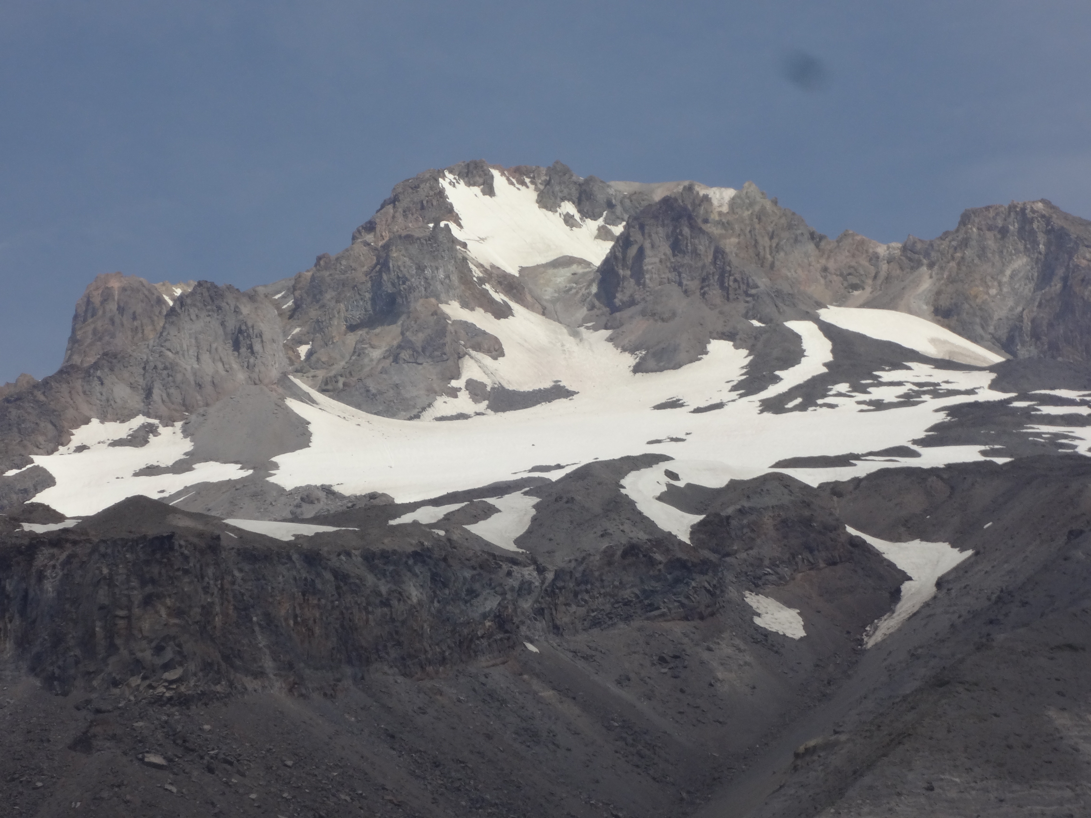
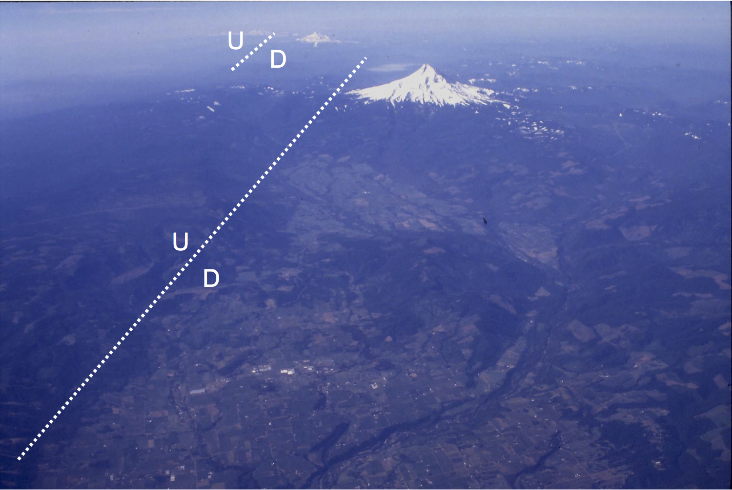
This picture was taken from the Timberline Trail on the south side of the Zigzag River Canyon. The cliff in the foreground is the Mississippi Head. This is an intra-canyon lava flow that erupted during the Polallie eruptive period 13,000 to 20,000 years ago (Scott et al 1997). Lavas flow down slope from their vents. They enter stream valleys and follow these until they solidify. The Mississippi Head lava flow is within a valley (or canyon) eroded into older mudflows, debris flows, and pyroclastic flows. It is overlain by young glacial drift and even younger volcanic deposits erupted during the Timberline (~1500 years ago) and Old Maid Flat (late 1800’s) events.
On the left skyline above Mississippi Head we see Yokum Ridge, an andesite lava flow that is about 303,000 years old. Just in front of Yokum Ridge is Illumination Rock, another Polallie period andesite flow. These two features are examples of “inverted topography”, a common topographic feature of volcanic regions. Just as the Mississippi Head lava flow filled an older canyon, both Yokum Ridge and Illumination Rock moved away from their summit area vents into valleys carved into the flank of Mt Hood. The material underlying the valley walls was easily removed by erosion. Over time, the valley walls were worn away by running water and mass wasting. The lava flows were more resistant to erosion, so they remained behind. T
hus a topographic valley was filled with lava, and following erosion the lava formed a ridge where the valley had been. The valley topography was thus “inverted” to become a ridge.
The summit ridge above Yokum Ridge and Illumination Rock consists of eroded dacite domes, lava flows, and possible eruptive vents. In many places, these are broken, or “brecciated”, by fractures. The fractures were conduits for volcanic gas to reach the surface. The area around the fractures is highly altered by the passage of the gasses.
The right skyline of the summit is known as the Steel Cliffs. This is an eroded lava dome that may be where the Polallie age volcanic rocks erupted.
Crater Rock is the dacite dome sitting in the middle of the summit area, below the summit ridge. This is the vent for the most recent eruptive event, the late eighteenth century Old Maid Flat eruption. Below the Crater Rock, the snow fields cover the volcanic debris shed from the vent. The debris forms a fan that extends from Crater Rock down the south side of Mt Hood to Timberline Lodge. It covers older lava flows, such as the one at Mississippi Head, as well as older debris flows that erupted from Mt Hood 1.5, 13 to 20, and 30 to 50 thousand years ago. Below these debris flows are older lava flows ranging from 200 to 500 thousand years ago.
Scott et al 1997 Geologic History of Mount Hood Volcano, Oregon-A Field Trip Guidebook. USGS Open File Report 97-263.
http://pubs.usgs.gov/of/1997/0263/report.pdf